
Newport Beach ZIP Code Coverage
Newport Beach’s official city GIS ZIP map shows six principal geographic ZIP areas. Local postal material also associates 92658 with Newport Beach operations, although that code is not drawn as a normal residential polygon on the city map. The table keeps those two kinds of evidence together without treating them as interchangeable. “Areas covered” follows the city map and local usage, while the post-office column preserves the station or network description reported in the research.
| ZIP | Areas covered | Post office | Notes |
|---|---|---|---|
| 92625 | Corona del Mar, including village and coastal areas | Corona del Mar, 406 Orchid Ave. | Postal name may be Corona del Mar. |
| 92657 | Newport Coast, Crystal Cove, and Pelican-area communities | Newport and Newport Coast postal network | Modern southeastern city geography. |
| 92660 | Central and northern mainland, Eastbluff, Dover, Westcliff, and Newport Center | Camelback main station, 1133 Camelback St. | Broadest principal mainland ZIP. |
| 92661 | Balboa Peninsula east end and Balboa village area | Balboa Newport Beach, 204 Main St. | Small, narrow peninsula area. |
| 92662 | Balboa Island and Little Balboa Island | Balboa-area postal service | Compact island ZIP. |
| 92663 | West Newport, western and central peninsula, Newport Heights, and Mariners Mile | Mariners Mile, 191 Riverside Ave., and network | Western delivery geography reaches near city borders. |
| 92658 | Special, PO-box, or postal-facility-associated Newport Beach use | Camelback and Newport S&DC operations | Not shown as a normal residential polygon on the city map. |
A post-office name can describe a delivery convention rather than a municipal neighborhood. For a single address, the ZIP code directory should be checked against the official city map and then verified through USPS. For a parcel question, the city’s jurisdiction and annexation layers matter more than the preferred postal city line.
Why Newport Beach ZIP 92658 Differs
92658 is the profile-3 geographic quirk in Newport Beach postal research. The city’s map identifies six standard ZIP polygons, yet USPS materials group 92658 with Newport delivery operations. Research describes it as a special, PO-box, or postal-facility-associated code, not as a broad neighborhood polygon. That distinction matters when a search form accepts a ZIP but the map does not show a matching residential area.
A September 2025 USPS service-delivery-center notice placed Newport S&DC operations at 1133 Camelback Street and grouped 92625, 92657, 92658, and 92660 through 92663 in the notice. The notice also said the operational change did not itself close post offices or change customer service. The USPS service-area notice is useful context, but it is not a parcel boundary source.
92658 check. Do not turn a USPS operational code into a claim that a visible residential district is missing from the Newport Beach GIS map. Verify the specific mailing address first.
Newport Beach ZIP 92625: Corona del Mar
92625 follows the Corona del Mar part of Newport Beach, including village and coastal areas shown on the city ZIP map. Its postal identity may read Corona del Mar even when the parcel falls inside Newport Beach’s municipal jurisdiction. That makes 92625 a good example of why a ZIP code directory needs both a postal view and a civic map.
The Corona del Mar station listed in the research is at 406 Orchid Avenue. The station detail helps verify postal context, while the Newport Beach GIS ZIP boundary map helps compare that context with city parcels and neighboring areas. A family researcher using an older address should keep “Corona del Mar” as a separate locality label rather than silently replacing it with a modern city term.
Newport Beach ZIP 92657: Later Geography
92657 covers Newport Coast and communities associated with Crystal Cove and the Pelican area. It belongs to a later southeastern geography than the older Newport Beach core. A current ZIP match therefore says little about how an address would have appeared in a 1920s directory, when Newport Coast was not yet part of the same municipal and postal research frame.
The city’s annexation chronology is the better historical bridge. The Newport Beach annexation map shows how the incorporated footprint expanded through multiple decades. Use the modern ZIP code to locate a present address, then search the older community or county heading that matches the record’s own date. This prevents a later 92657 label from being projected backward into an earlier resident directory.
Note: Newport Coast’s later annexation geography should be treated as a time marker, not as a substitute for the locality printed on an older record.
Newport Beach ZIP 92660: Broad Mainland
92660 is the broad mainland ZIP in the Newport Beach map. It includes central and northern areas such as Eastbluff, Dover, Westcliff, and Newport Center. The research identifies the Camelback main station at 1133 Camelback Street. These place names are useful search terms when a directory or newspaper uses a neighborhood label instead of the city name.
The size of 92660 does not make it a resident list. A parcel search still needs an address or APN, and an assessment record still identifies an owner or assessee rather than every person connected to the site. Use the ZIP to narrow a map or a business-address result, then retain the parcel, street, and locality fields that can distinguish one record from another.
Newport Beach ZIPs 92661 and 92662
92661 and 92662 are compact coastal areas with different physical settings. 92661 follows the east end of Balboa Peninsula and the Balboa village area, with the Balboa Newport Beach station listed at 204 Main Street. 92662 follows Balboa Island and Little Balboa Island. The two labels can therefore separate peninsula research from island research even when both appear under a Newport Beach postal identity.
Island and peninsula records often need more than a ZIP field. Preserve street names, local terms, parcel or lot context, and any mooring identifier that appears in a city record. A postal result can place an address in the right delivery area, but the city GIS map is what supplies the jurisdictional and parcel frame for a lawful neighborhood or property inquiry.
Newport Beach ZIP 92663: Western Areas
92663 covers West Newport, western and central parts of the peninsula, Newport Heights, and the Mariners Mile area. The research lists Mariners Mile at 191 Riverside Avenue along with the surrounding postal network. Local records can also carry neighboring delivery geography near Costa Mesa or Huntington Beach, so a 92663 result should not be read as a complete city-limit test.
When a record search returns 92663, compare the street and parcel with the city GIS boundary. The same ZIP code can be useful for grouping a newspaper search or business-address result, while the APN and legal description answer which land parcel is involved. That two-part check keeps a ZIP code directory from blurring western neighborhood history with postal routing.
Finding Residents by Newport Beach ZIP
A ZIP-keyed search works best as a narrowing step, not as a promise of a downloadable resident roll. The research did not verify an official public portal that offers a ZIP-wide owner or resident export. It did identify several ways to use ZIP information without overstating what each system proves.
- Verify the complete address with USPS, including the preferred city line and ZIP+4 when available.
- Open the Newport Beach GIS map, display the ZIP layer, and confirm the parcel’s civic location and neighborhood context.
- Use the assessor gateway for a parcel or address inquiry, while noting that the public landing page does not document an unrestricted ZIP-wide owner search.
- Use a city business-tax search only for a business connection, since its results can contain an address, owner or entity, ZIP, dates, and status rather than a household roster.
- Request voter-file geography only through the qualified California process, not by entering another person’s address into the self-lookup tool.
Once a ZIP has narrowed the geography, an address-level question belongs in the Newport Beach street directory workflow. That next step moves from a postal area to a street, APN, parcel map, and records custodian without treating ZIP codes as people indexes.
Newport Beach ZIP Portal Limits
The most important search-field fact is often a missing field. Newport Beach’s research shows where ZIP information appears, where it can be layered onto a map, and where a public form does not document a ZIP-wide resident query. The table separates a field or layer from the result a researcher may reasonably draw.
| Portal or source | ZIP-related field or layer | Useful result | Limit |
|---|---|---|---|
| USPS address lookup | Complete address and ZIP+4 request | Delivery ZIP and preferred city context | Does not establish city jurisdiction. |
| Newport Beach GIS | ZIP polygon layer | Map context, parcel relationship, and civic geography | Not a public resident list or verified radius export. |
| OC Assessor gateway | Address, APN, and parcel information where documented | Parcel-level ownership and mailing/situs clues | Unrestricted ZIP-wide owner searching was not verified. |
| City business-tax search | Business name, business address, and category | Result ZIP, owner or entity, dates, and status | Commercial association is not home occupancy. |
| California voter-file application | Requested geographic scope, with active/inactive and history choices | Approved users may receive permitted residential and precinct fields | Qualified purpose, approval, fees, and use limits apply. |
The public California My Voter Status form is an exact-match self-lookup using a name, birth date, and identifying information. It is not a ZIP browser. The broader voter file has a separate application route and can include residential and mailing address fields for qualified purposes, but it cannot be republished as a casual Newport Beach residents directory.
Note: A ZIP filter can group records, but an APN, legal description, or custodian citation is still needed to verify the underlying subject.
Newport Beach ZIP Boundaries and City Limits
ZIP codes are delivery routes, not municipal borders. A parcel inside Newport Beach may use Corona del Mar or Newport Coast as its preferred postal city, while a Newport Beach last line can reflect postal operations beyond a civic neighborhood. The city GIS boundary and annexation layers answer jurisdiction. USPS answers delivery. Neither layer alone creates a household directory.
The Census geographic summary-file reference adds a separate population and disclosure context for geographic research. It should not be used as a ZIP-level list of named residents.
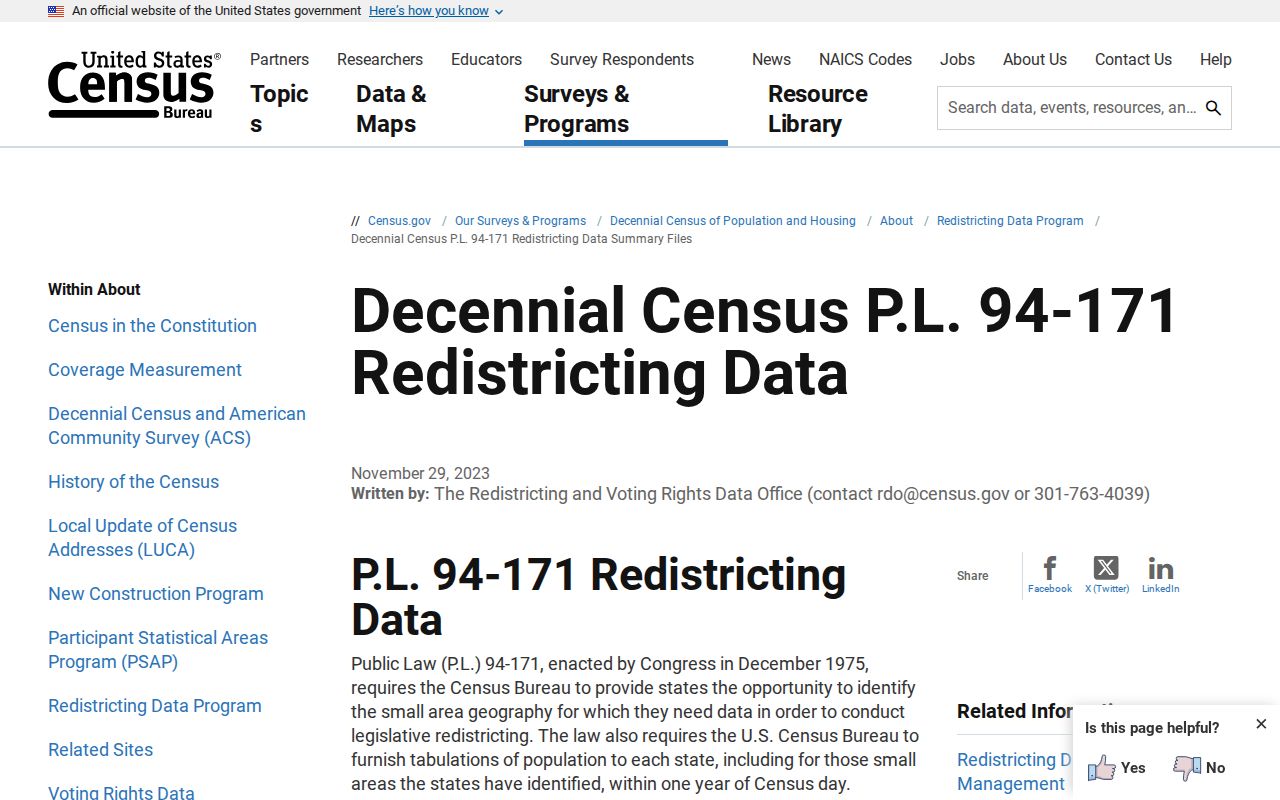
The Census source helps distinguish public geographic summaries from person-level records. A count or tract table can describe an area without identifying the people inside it.
Newport Beach ZIP Population Context
The Census QuickFacts profile for Newport Beach reports 85,239 residents in the 2020 Census and a July 1, 2025 estimate of 81,977. Those figures provide citywide context for the ZIP code directory, not a count of named residents in any one postal area.
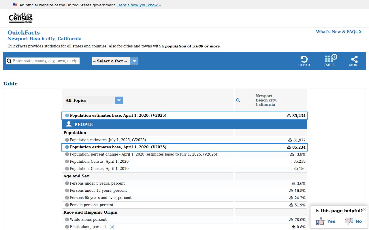
Population context is useful when judging scale, but it cannot replace the address, APN, date, and source-custodian checks required for a personal record search.
Newport Beach ZIP Search Terms
Postal terms can sound like parcel terms even when they answer different questions. Clear definitions keep a Newport Beach ZIP code directory from turning a delivery label into an ownership or occupancy claim.
Use the narrowest term that matches the task. ZIP information is strongest for routing and geographic grouping. APNs, deeds, maps, and custodian records are stronger for land identity or historical proof.
- ZIP code
- A USPS delivery area used to sort and route mail. It may cross a civic boundary or use a preferred city name that differs from the municipality.
- ZIP+4
- An added four-digit delivery segment used to refine an address beyond the five-digit ZIP. It does not change the city jurisdiction.
- PO-box or facility-associated ZIP
- A code used for a postal facility, box service, or special operation rather than a broad residential polygon. The research places 92658 in this kind of distinction.
- Unique ZIP
- A ZIP assigned to a single institution or tightly defined delivery point. It should not be treated as proof that every nearby parcel shares the same postal use.
- Carrier route
- A delivery sequence within a postal area. It can make routing precise while remaining unrelated to a city parcel boundary.